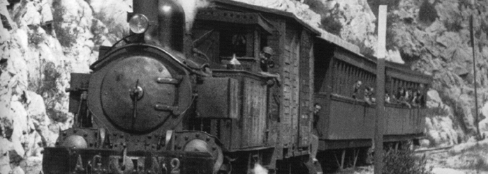
Barranc de L’Encantà
Barranc de L’Encantà
El barranc de l’Encantà debe su nombre a una leyenda posterior a la Reconquista que el erudito botánico Antonio Cavanilles recoge en su obra Observaciones: “barranco que la credulidad llamó de la Encantada por la piedra circular de unos cinco pies de diámetro, que en forma de ventana cerrada se ve en la garganta del barranco a 20 pies sobre el nivel ordinario de las aguas. En esta fingió el vulgo la boca de cierta mina donde los Moros escondieron sus tesoros y dexáron encantada una doncella, que cada cien años sale para volver á entrar en el mismo día.”
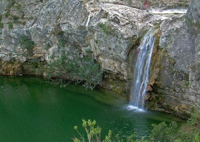
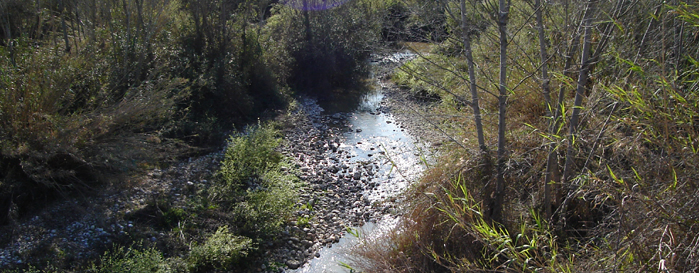
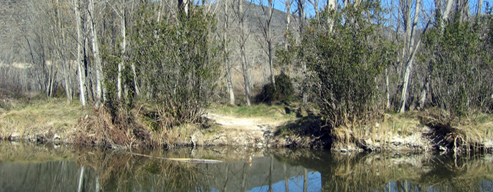
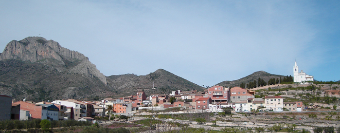
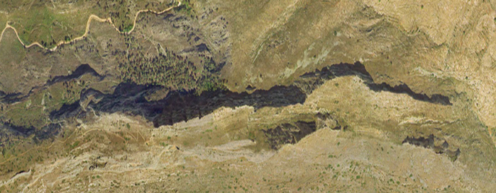
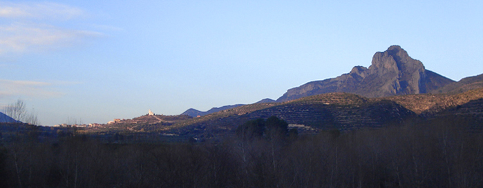
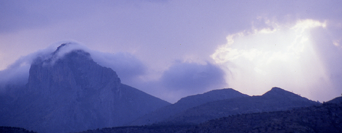
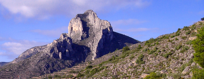
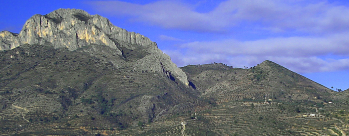
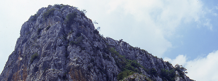
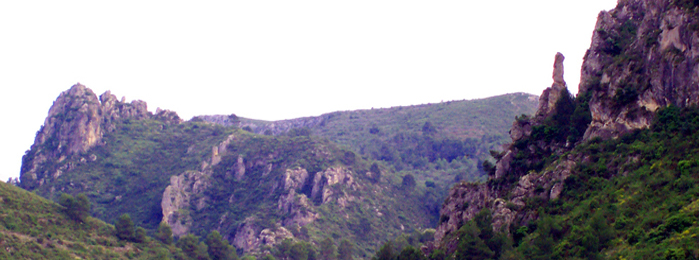
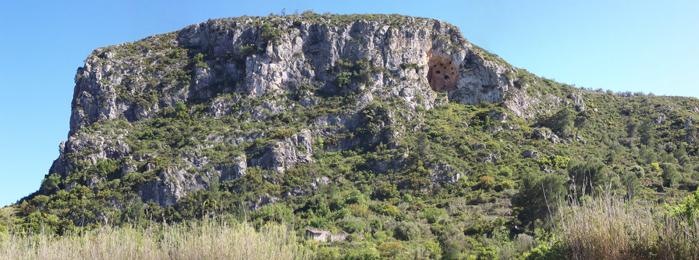
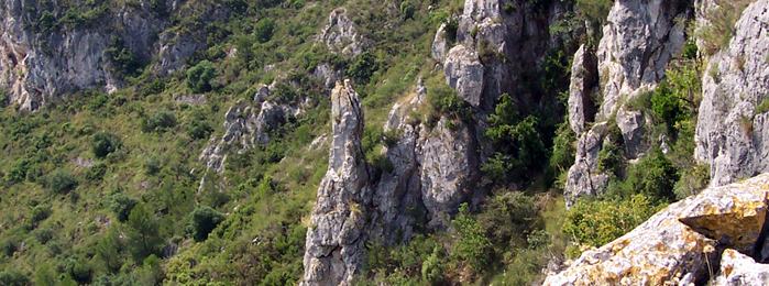
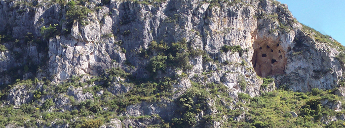
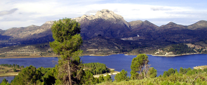
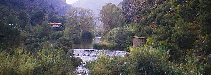
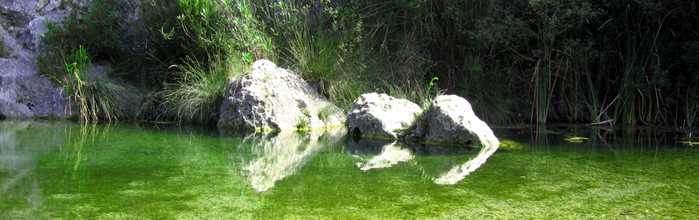
Nace en las proximidades de Beniaia, en la Vall d’Alcalà, discurre por el término de Planes, atravesando una serie de gargantas excavadas en las formaciones calizas de la Sierra de Cantacuc y desfilando hacia Beniarrés enclavado entre las sierras de l’Albureca y del Cantalar en busca del río Serpis, al que tributa sus aguas. En total, l’Encantà recorre más de 8 kilómetros de un barranco agreste, formando un conjunto de gran belleza paisajística y contrastado valor faunístico y botánico.
FAUNA
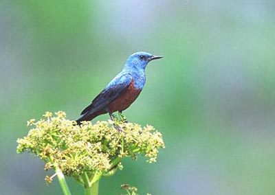
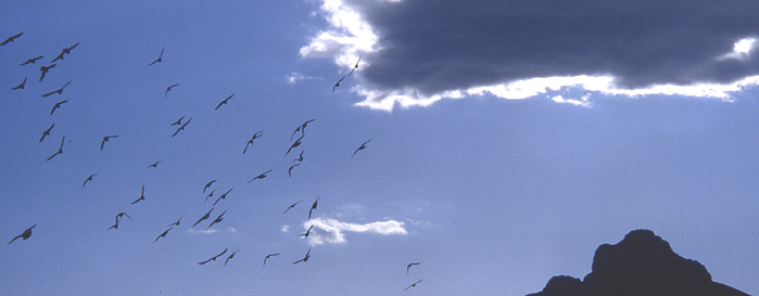
 Entre las especies acuáticas más importantes destaca el samaruco (Valencia hispanica), endemismo piscícola valenciano que desapareció del paraje tras la introducción de la trucha arco iris, el barbo mediterráneo (Barbus guiraonis), endemismo ibérico catalogado como especie rara, la gamba de río (Dugastella valentina) endemismo valenciano otrora abundante y también desaparecido del lugar -aunque no de otras fuentes próximas-, la rana común (Rana perezi), endémica de la Península Ibérica, el sapo común (Bufo bufo), la culebra viperina (Natrix maura) y la rata de agua (Arvicola sapidus). Entre la avifauna encontraremos la garza real (Ardea cinerea), la garceta blanca (Casmerodius albus), las pollas de agua(Gallinula chloropus), la lavandera blanca (Motacilla alba), la lavandera cascadeña (Motacilla cinerea), el martín pescador(Alcedo atthis) y, en primavera y verano, el ruiseñor común (Luscinia megarhynchos) y otros tantos pájaros acompañarán nuestra estancia con sus deliciosos cantos. En las paredes rocosas situadas cerca del río suelen situarse especies interesantes como el gorrión chillón (Petronia petronia), el avión roquero (Riparia riparia), el colirrojo tizón (Phoenicurus ochruros), el roquero solitario (Monticola solitarius), el búho real (Bubo bubo), el cernícalo (Falco tinnunculus), el águila perdicera (Hieraetus fasciatus) y un largo etcétera entre los que no pueden faltar diferentes especies de murciélagos. También encontraremos una gran cantidad de fringílidos como verderones, verdecillos, pinzones y jilgueros. Existen también especies mayores, muy interesantes pero difíciles de observar por sus costumbres nocturnas como son la gineta (Genetta genetta), el turón (Mustela putorius), el zorro rojo (Vulpes vulpes) y el jabalí (Sus scrofa).
FLORA ARBÓREA
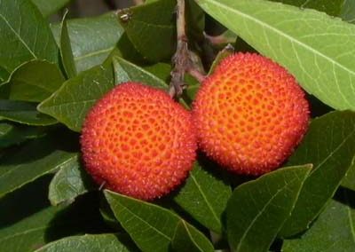
 En cuanto a la vegetación, se trata de la típica vegetación mediterránea: árboles y arbustos en general perennifolios y esclerófilos, es decir, de hojas pequeñas, duras y a menudo espinosas, para ahorrar agua a lo largo del período estival. La estructura de la vegetación varía según su localización, así como de su situación en solana o umbría. Existen algunas pinadas de pino carrasco (Pinus halepensis) de poca extensión, junto con algunos ejemplares de carrasca (Quercus rotundifolia) que, de forma dispersa, aparecen por el paraje recordándonos lo que en otros tiempos fueron extensas formaciones boscosas. Menos abundante es el madroño (Arbutus unedo) cuya población, junto con el cerezo de Santa Lucía (Prunus mahaleb), está prevista reforzar dentro del Plan de gestión de la Microrreserva de flora de l’Alt de Senabre que linda con l’Encantà. También está prevista la reintroducción del fresno de flor (Fraxinus ornus), árbol caducifolio de hojas compuestas, que antaño existía y actualmente ha desaparecido.
FLORA ARBUSTÍFERA
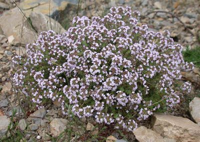
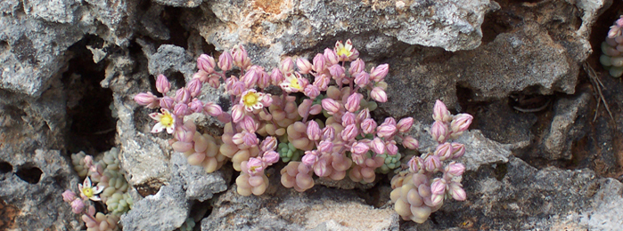
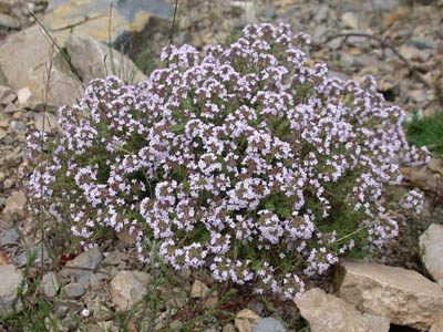
 Entre los arbustos abunda el lentisco (Pistacia lentiscus) y la cornicabra (Pistacia terebinthus). Otros arbustos también abundantes son el enebro (Juniperus oxycedrus), la coscoja (Quercus coccifera), planta próxima a la carrasca pero con hojas de un verde más nítido, la aliaga (Ulex parviflorus), arbusto fuertemente espinoso y con flores de un color amarillo intenso que dan color al paisaje invernal, el brezo (Erica multiflora) de hojas reducidas y flores de color rosa pálido y el palmito (Chamaerops humilis), única palmera autóctona de la Península Ibérica. Otra especie interesante es la sabina (Juniperus phoenicea). En primavera destacan en el paisaje las grandes flores blancas o rosas de las jaras (Cistus albidus, Cistus salviifolius, Cistus monspeliensis). Entre las plantas aromáticas, mayoritariamente de la familia de las labiadas, son abundantes el romero (Rosmarinus officinalis), el tomillo (Thymus vulgaris), la ajedrea (Satureja obovata) y, en menor abundancia, la pebrella (Thymus piperella), especie protegida por ser endemismo ibero-levantino.
Asimismo, en la Microrreserva de flora de l’Alt de Senabre que linda con l’Encantà, se han catalogado 252 especies en apenas 5,61 hectáreas –de las cuales 13 son endémicas, 11 son raras con riesgo menor de extinción, 3 están amenazadas y otras 5 son especies protegidas en el ámbito autonómico–, lo que puede dar una idea de la biodiversidad florística de la zona.
VEGETACIÓN DE RIBERA
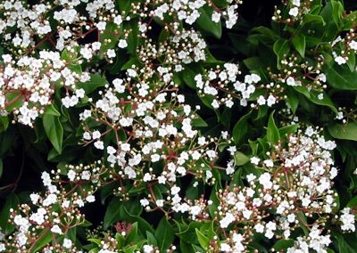
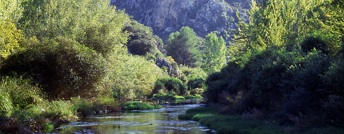
 Junto al cauce aparece otro tipo de vegetación, dependiente del agua: la vegetación de ribera. Entre los árboles destacan el chopo (Populus nigra) y el álamo blanco (Populus alba), los dos caducifolios, fácilmente distinguibles entre sí por las hojas. Aparecen también diversas especies de sauces (Salix eleagnos), así como la abundante adelfa (Nerium oleander), de grandes flores rosadas y venenosa tanto para el hombre como para el ganado. Junto a ésta resulta fácil encontrar el tamarindo (Tamarix gallica), la zarzamora (Rubus ulmifolius), formaciones de caña (Arundo donax). Muy cerca del río aparecen de forma dispersa formaciones de carrizo (Phragmites australis), un tipo de caña no tan alta pero más estilizada que requiere la presencia de agua, al menos de forma estacional, la cola de caballo (Equisetum telmaitea), el yezgo (Sambucus ebulus), la unciana (Dorycnium rectum), el rosal silvestre (Rosa micrantha), la esparraguera (Asparagus acutifolius), el mirto (Myrtus communis), el brusco (Ruscus aculeatus), la carrasquilla (Rubia peregrina), la zarzaparrilla (Smilax aspera) y el durillo (Viburnum tinus). Ocupando el mismo nicho ecológico, en la orilla, es fácil encontrar la enea (Typha dominguensis), con unas largas hojas, siendo muy característica su inflorescencia en forma de puro, y el junco (Schoenus nigricans). También se conocen en la zona varias especies de helechos, como el helecho hembra (Pteridium aquilinum), el polipodio (Poyipodium vulgare) y el culantrillo de pozo (Adiantum capillus-veneris), que vive en ambientes húmedos con goteo de agua.
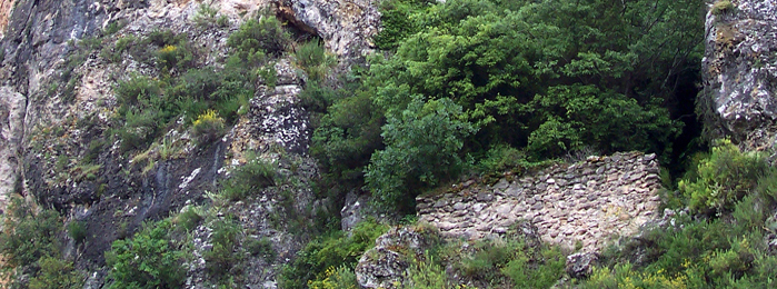
Con la intención de regenerar y/o recuperar este interesantísimo patrimonio natural, la Regidoria de Turisme i Medi Ambient elaboró una Memoria descriptiva y encargó la redacción de un Proyecto de restauración medioambiental del barranc de l’Encantà con el que se solicitó a la Confederación Hidrográfica del Júcar (CHJ) que autorizase la actuación propuesta. Este proyecto trata de ordenar y compatibilizar los usos sociales que tradicionalmente se han desarrollado en la desembocadura de este paraje con la recuperación y potenciación de sus valores naturales. Así, a la propuesta de su total peatonalización se suma la creación de una zona de recepción y amortiguación, la ordenación y adecuación de los accesos y sendas, la prohibición de acampar o prender fuegos, el reforzamiento de las especies amenazadas y la reintroducción de las desaparecidas, así como la redacción de un Plan de gestión integral que compatibilice y complemente sus usos con los de la Microrreserva de flora de l’Alt de Senabre.