NOTICE ADMITTED AND CONSTITUTION IN THE WORK BOOK FOR THE MUNICIPAL POOL SERVICE 2017
 list of admitted Notice
Order in job board notice
SCHOOL OF CHESS IN BENIARRÉS

For the second consecutive year, the City Council of Beniarrés, organizes during summer vacations dates a school of Chess. School subsidized by the Hon. Provincial Council of Alicante.
2017 Gastronomic Fair
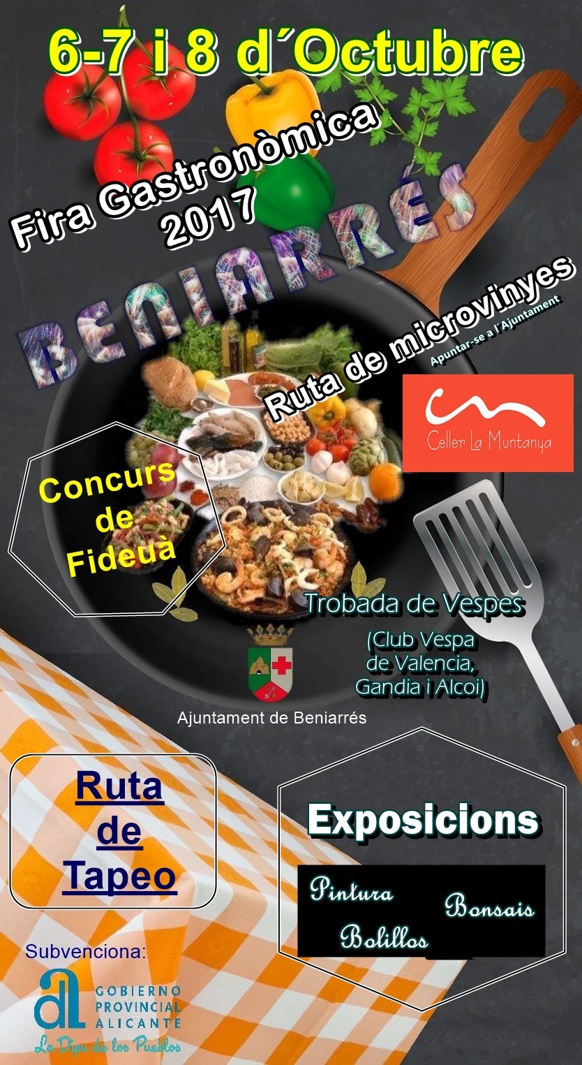
Thursday 5th of October.
In the morning the tickets will be sold at the Town Hall (Office hours).
Friday 6th of October.
In the morning the tickets will be sold at the Town Hall (Office hours).
Tapas Route from 7:00 pm, through the village bars.
At 8:00 pm, the exhibitions will be opened. (Bonsai, Bolillos, Painting)
Saturday 7th of October.
Route of the tapas all day through the bars of the village.
About 12:00 a.m. (approx.), We will have the visit of the Vespa Clubs of Valencia, Gandia and Alcoy. The Wasps will be exhibited at Rosa Escrig Street.
At 1:30 p.m., Fideuà competition. All the participants who are interested (both associations and individuals) must sign up to the City Council.
At 2:00 pm, Fideuà tasting.
¨Large folklore¨, on Doctor Orero Street, brightened up by the drink.
At 11:00 p.m., at Doctor Orero Street, the popular Xeno Trio Revetla.
Sunday 8 of October.
At 09:00, there will be a small talk of the knowledge of our vineyards and we will do a microvinye route, which will end with a breakfast and a wine tasting. All the participants who are interested must register at the Town Hall.
Route of the tapas all day through the bars of the village.
At 11:00 a.m. we will have to pack us with a demonstration of everything they know how to do.
In all the bars tickets will be sold throughout the weekend
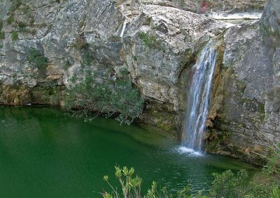
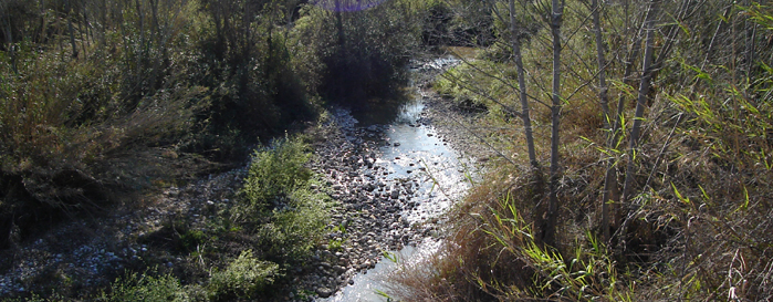
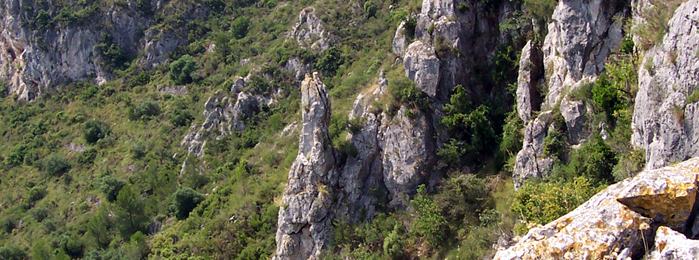
Barranc de L’Encantà
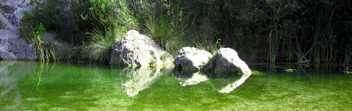
Barranc de L’Encantà
El barranc de l’Encantà debe su nombre a una leyenda posterior a la Reconquista que el erudito botánico Antonio Cavanilles recoge en su obra Observaciones: “barranco que la credulidad llamó de la Encantada por la piedra circular de unos cinco pies de diámetro, que en forma de ventana cerrada se ve en la garganta del barranco a 20 pies sobre el nivel ordinario de las aguas. En esta fingió el vulgo la boca de cierta mina donde los Moros escondieron sus tesoros y dexáron encantada una doncella, que cada cien años sale para volver á entrar en el mismo día.”
Nace en las proximidades de Beniaia, en la Vall d’Alcalà, discurre por el término de Planes, atravesando una serie de gargantas excavadas en las formaciones calizas de la Sierra de Cantacuc y desfilando hacia Beniarrés enclavado entre las sierras de l’Albureca y del Cantalar en busca del río Serpis, al que tributa sus aguas. En total, l’Encantà recorre más de 8 kilómetros de un barranco agreste, formando un conjunto de gran belleza paisajística y contrastado valor faunístico y botánico.
FAUNA
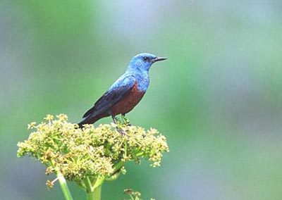
 Entre las especies acuáticas más importantes destaca el samaruco (Valencia hispanica), endemismo piscícola valenciano que desapareció del paraje tras la introducción de la trucha arco iris, el barbo mediterráneo (Barbus guiraonis), endemismo ibérico catalogado como especie rara, la gamba de río (Dugastella valentina) endemismo valenciano otrora abundante y también desaparecido del lugar -aunque no de otras fuentes próximas-, la rana común (Rana perezi), endémica de la Península Ibérica, el sapo común (Bufo bufo), la culebra viperina (Natrix maura) y la rata de agua (Arvicola sapidus). Entre la avifauna encontraremos la garza real (Ardea cinerea), la garceta blanca (Casmerodius albus), las pollas de agua(Gallinula chloropus), la lavandera blanca (Motacilla alba), la lavandera cascadeña (Motacilla cinerea), el martín pescador(Alcedo atthis) y, en primavera y verano, el ruiseñor común (Luscinia megarhynchos) y otros tantos pájaros acompañarán nuestra estancia con sus deliciosos cantos. En las paredes rocosas situadas cerca del río suelen situarse especies interesantes como el gorrión chillón (Petronia petronia), el avión roquero (Riparia riparia), el colirrojo tizón (Phoenicurus ochruros), el roquero solitario (Monticola solitarius), el búho real (Bubo bubo), el cernícalo (Falco tinnunculus), el águila perdicera (Hieraetus fasciatus) y un largo etcétera entre los que no pueden faltar diferentes especies de murciélagos. También encontraremos una gran cantidad de fringílidos como verderones, verdecillos, pinzones y jilgueros. Existen también especies mayores, muy interesantes pero difíciles de observar por sus costumbres nocturnas como son la gineta (Genetta genetta), el turón (Mustela putorius), el zorro rojo (Vulpes vulpes) y el jabalí (Sus scrofa).
FLORA ARBÓREA
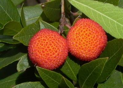
 En cuanto a la vegetación, se trata de la típica vegetación mediterránea: árboles y arbustos en general perennifolios y esclerófilos, es decir, de hojas pequeñas, duras y a menudo espinosas, para ahorrar agua a lo largo del período estival. La estructura de la vegetación varía según su localización, así como de su situación en solana o umbría. Existen algunas pinadas de pino carrasco (Pinus halepensis) de poca extensión, junto con algunos ejemplares de carrasca (Quercus rotundifolia) que, de forma dispersa, aparecen por el paraje recordándonos lo que en otros tiempos fueron extensas formaciones boscosas. Menos abundante es el madroño (Arbutus unedo) cuya población, junto con el cerezo de Santa Lucía (Prunus mahaleb), está prevista reforzar dentro del Plan de gestión de la Microrreserva de flora de l’Alt de Senabre que linda con l’Encantà. También está prevista la reintroducción del fresno de flor (Fraxinus ornus), árbol caducifolio de hojas compuestas, que antaño existía y actualmente ha desaparecido.
FLORA ARBUSTÍFERA
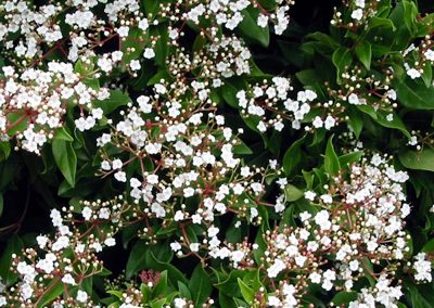
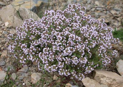
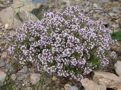
 Entre los arbustos abunda el lentisco (Pistacia lentiscus) y la cornicabra (Pistacia terebinthus). Otros arbustos también abundantes son el enebro (Juniperus oxycedrus), la coscoja (Quercus coccifera), planta próxima a la carrasca pero con hojas de un verde más nítido, la aliaga (Ulex parviflorus), arbusto fuertemente espinoso y con flores de un color amarillo intenso que dan color al paisaje invernal, el brezo (Erica multiflora) de hojas reducidas y flores de color rosa pálido y el palmito (Chamaerops humilis), única palmera autóctona de la Península Ibérica. Otra especie interesante es la sabina (Juniperus phoenicea). En primavera destacan en el paisaje las grandes flores blancas o rosas de las jaras (Cistus albidus, Cistus salviifolius, Cistus monspeliensis). Entre las plantas aromáticas, mayoritariamente de la familia de las labiadas, son abundantes el romero (Rosmarinus officinalis), el tomillo (Thymus vulgaris), la ajedrea (Satureja obovata) y, en menor abundancia, la pebrella (Thymus piperella), especie protegida por ser endemismo ibero-levantino.
Asimismo, en la Microrreserva de flora de l’Alt de Senabre que linda con l’Encantà, se han catalogado 252 especies en apenas 5,61 hectáreas –de las cuales 13 son endémicas, 11 son raras con riesgo menor de extinción, 3 están amenazadas y otras 5 son especies protegidas en el ámbito autonómico–, lo que puede dar una idea de la biodiversidad florística de la zona.
VEGETACIÓN DE RIBERA
 Junto al cauce aparece otro tipo de vegetación, dependiente del agua: la vegetación de ribera. Entre los árboles destacan el chopo (Populus nigra) y el álamo blanco (Populus alba), los dos caducifolios, fácilmente distinguibles entre sí por las hojas. Aparecen también diversas especies de sauces (Salix eleagnos), así como la abundante adelfa (Nerium oleander), de grandes flores rosadas y venenosa tanto para el hombre como para el ganado. Junto a ésta resulta fácil encontrar el tamarindo (Tamarix gallica), la zarzamora (Rubus ulmifolius), formaciones de caña (Arundo donax). Muy cerca del río aparecen de forma dispersa formaciones de carrizo (Phragmites australis), un tipo de caña no tan alta pero más estilizada que requiere la presencia de agua, al menos de forma estacional, la cola de caballo (Equisetum telmaitea), el yezgo (Sambucus ebulus), la unciana (Dorycnium rectum), el rosal silvestre (Rosa micrantha), la esparraguera (Asparagus acutifolius), el mirto (Myrtus communis), el brusco (Ruscus aculeatus), la carrasquilla (Rubia peregrina), la zarzaparrilla (Smilax aspera) y el durillo (Viburnum tinus). Ocupando el mismo nicho ecológico, en la orilla, es fácil encontrar la enea (Typha dominguensis), con unas largas hojas, siendo muy característica su inflorescencia en forma de puro, y el junco (Schoenus nigricans). También se conocen en la zona varias especies de helechos, como el helecho hembra (Pteridium aquilinum), el polipodio (Poyipodium vulgare) y el culantrillo de pozo (Adiantum capillus-veneris), que vive en ambientes húmedos con goteo de agua.
Con la intención de regenerar y/o recuperar este interesantísimo patrimonio natural, la Regidoria de Turisme i Medi Ambient elaboró una Memoria descriptiva y encargó la redacción de un Proyecto de restauración medioambiental del barranc de l’Encantà con el que se solicitó a la Confederación Hidrográfica del Júcar (CHJ) que autorizase la actuación propuesta. Este proyecto trata de ordenar y compatibilizar los usos sociales que tradicionalmente se han desarrollado en la desembocadura de este paraje con la recuperación y potenciación de sus valores naturales. Así, a la propuesta de su total peatonalización se suma la creación de una zona de recepción y amortiguación, la ordenación y adecuación de los accesos y sendas, la prohibición de acampar o prender fuegos, el reforzamiento de las especies amenazadas y la reintroducción de las desaparecidas, así como la redacción de un Plan de gestión integral que compatibilice y complemente sus usos con los de la Microrreserva de flora de l’Alt de Senabre.
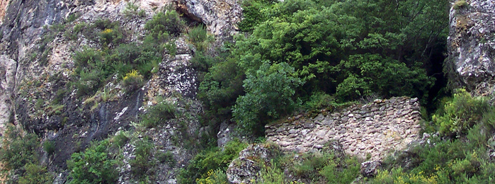
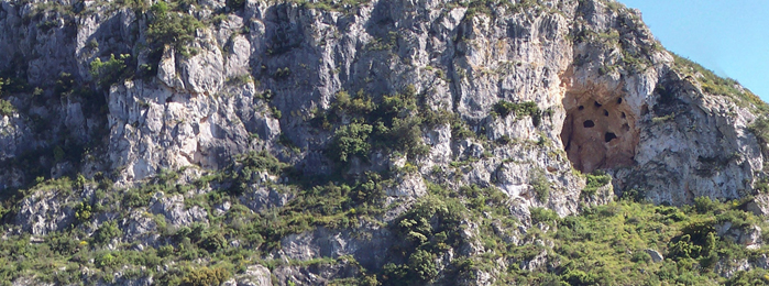
Cova de L’Or
Cova de L’Or
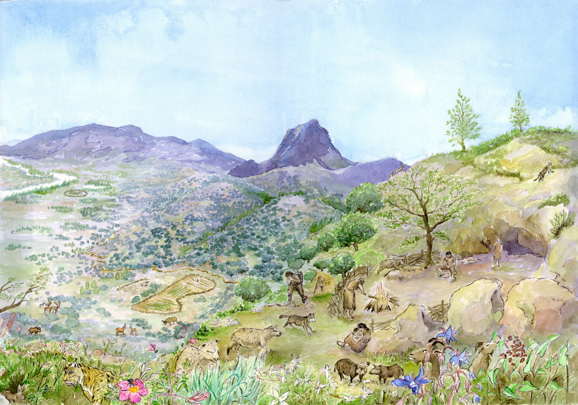
THE TIME OF THE FIRST FARMER AND SHEPHERD
Excavation campaigns

The Cova d’Or opens on the southern slope of the Benicadell mountain range, dominating the valley of the river of Alcoy. It is a cave with excellent living conditions that welcomed one of the groups of farmers and pioneering breeders of Mediterranean origin that expanded through our lands since the middle of the 6th millennium BC (5600 BC).
The first news as an archeological site are from 1933, when R. Pardo made some tastings. Explored again by the Museum of Alcoy, in 1955 the excavation campaigns of the Prehistoric Research Service of the Diputación of Valencia began, in front of which they were J. San Valero and V. Pascual, who would continue them from 1956 to 1958 .
 The wealth and importance of the deposit, especially its ceramics decorated by the impression of the edge of a Cardium shell, quickly became a key to the Neolithic Valencian research. The charred cereals were dated by the C14 method, with results reaching the date of 5550 BC, establishing the initial horizon of agriculture and livestock in the Iberian peninsula.
 New excavation campaigns and interdisciplinary research were resumed in 1975 by the SIP, now under the direction of V. Pascual and B. Martí until 1985.
THE COTIDIAN LIFE IN EL COVA DE L’OR
When the first Neolithic groups arrive at the Perputxent Valley, the climax has reached the temperature and humidity of the Atlantic period. Some conditions that enhanced the splendor of the Mediterranean forest of holm oaks, coconuts and strawberries, intermingled with deciduous trees such as quejigos, maples, ashs, cherry trees and thorns. In the solarium of Benicadell the warmest species such as the holly and the lens would be protected, or the most frugal like white pine, rosemary and jaras.

Towards the 5600 BC, this landscape begins to undergo a profound transformation and the Cave of Gold tells us about the footprint of human groups. The productive activities of the neolithic societies will reduce the forest to implant pastures and fields of culture. Charcoal remains show the cultivation of cereals such as wheat and barley, and legumes such as beans, lentils or peas. Regarding domestic animals, the predominance of sheep is very striking, with a small number of goats. The pig is well represented and scarcely the bull and the dog.
The farmer’s way of life requires the manufacture of a new domestic wardrobe, of which the ceramic vessels used to cook and store are part. The flint leaves are used as knives, or as elements of sickle. Polishing axes serve for wood work. And bone spoons confirm the changes in food habits, now based on cereals and legumes.
CERAMICS, ART AND RELIGION.

 Agriculture begins to develop in the Near East since the tenth millennium BC. With that distant origin the Neolithic communities are expanding and, through the Anatolia Peninsula, extend through the Balkans and the banks of the Aegean Sea well advanced in the seventh millennium. They are small communities that live in villages of ten cabins and that, as the number of families that make up them, they occupy new territories.
In the lands of the Mediterranean West these Neolithic groups receive the name of Culture of Printed Ceramics, according to the decoration of their glasses made by the impression of the Cardium shell. The recent research on the Golden Cave has made it possible to determine that the rich decoration of printed ceramics contains a broad repertoire of anthropomorphic motifs that are related to rock paintings, particularly those of the shelters of the Pla de Petracos in Castell de Castells and of the Sarga in Alcoy. That confirms that the first Neolithic communities were the authors of those cave paintings and, according to the central theme of the human figure with raised arms, the paintings and vessels would have a religious purpose.
SCHEDULE OF VISITS
concerted visits
Phone: 965 51 50 35/965 51 50 59
Text and coordination
Bernat Martí Oliver
Beniarrés Town Hall and MARQ
with the collaboration of
Museum of Prehistory of Valencia and Municipal Archaeological Museum of Alcoy
Location on the map
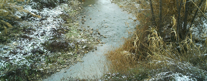
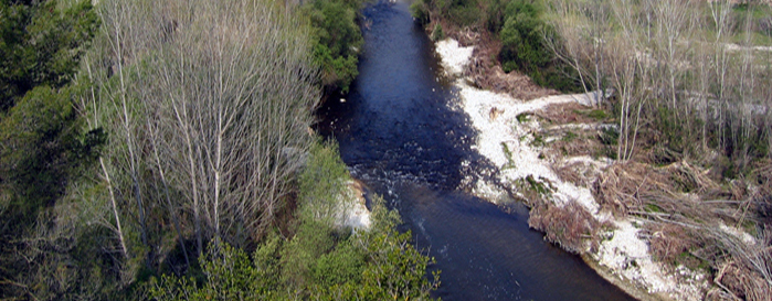
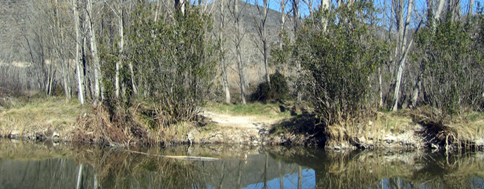
Protected place of the Serpis
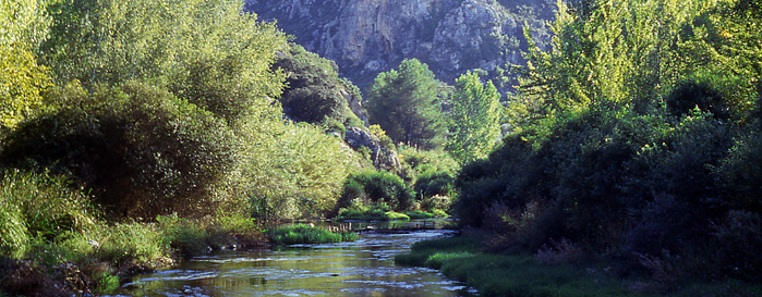
Protected place of the Serpis
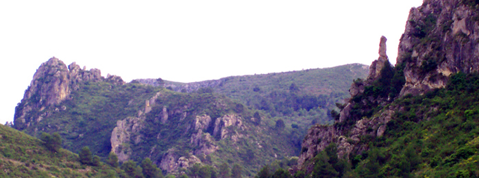
The stretch of the Serpis River between Beniarrés and Villalonga acts, together with its surroundings, as an element of connection between the mountain and the coast in the limits of the provinces of Valencia and Alicante. It is an exceptional mosaic of habitats and landscapes that synthesizes, like few Valencian territories, the basic characteristics and peculiarities of the Mediterranean mountain. The area has geomorphological qualities that make it worthy of special attention. In some sections, the secular erosive action of the river has given rise to unique spaces such as the Barranc de l’Encantà and the Inferno-Racó del Duque Straits. This gorge between the mountains of Safor and Cuta has made visible the geomorphological elements, forming a landscape of great value due to its uniqueness and its accessibility from the old Alcoy-Gandia railroad. This disused line is, at present, one of the biggest attractions in the area, with great possibilities for the ordered public use of the natural environment and the enjoyment of the landscapes.
The diverse mountainous and river environments propitiate a great variety of habitats. We find from important clusters of Mediterranean forest in good condition to remarkable riverside forests. There are many aquatic faunistic species of great interest, accompanied by birds, mammals and other vertebrates of special relevance, some of them scarce in the Valencian Community. It is a space with an exceptional landscape and remarkable ecological and geomorphological values.
There are also architectural elements of great historical value linked to the landscape, such as the engineering legacy that left the railroad (bridges, mounts and tunnels), Perputxent castle, mills of the late nineteenth century, azudes and small hydroelectric plants .
This historical interaction between the natural physical environment and human activity throughout the centuries, characterizes the landscape and the area of influence that is now protected in order to ensure its conservation and rational management. The protected space management system advocates the sustainable use of the natural resources of the Serpis River and its associated landscape, whose conservation criteria will be fixed by the wording of the corresponding Governing Plan for use and management that involves the Declaration of the Protected Landscape of the approved Serpis April 13, 2007.
Protected Landscape of La Solana del Benicadell
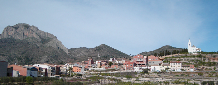
Protected Landscape of La Solana del Benicadell
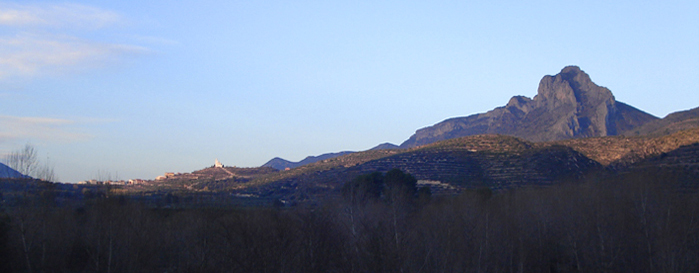
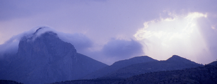
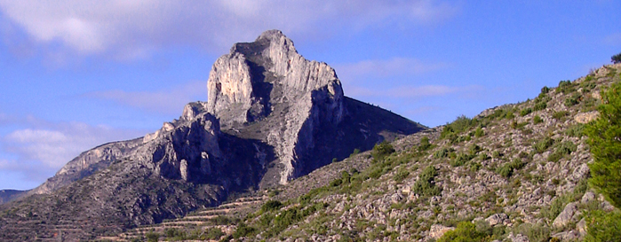
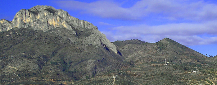
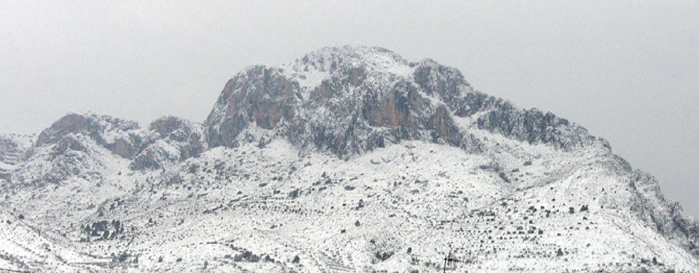
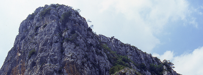
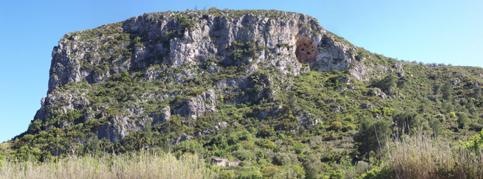
With a strong and vigorous relief, the Benicadell rises to 1,104 meters and extends along twenty-five kilometers in the northeast-southwest direction, rising over a clear landscape between the dilapidated valleys of Albaida and the County. Its main core is attached to the municipal terms of Muro, Gaianes, Beniarrés and Orxa, as regards the slope of the sun. On the east, the Sierra de Benicadell extinguishes in the ravines through which the Serpis River runs, specifically in the Barranc de l’Infern de l’Orxa; by the West, reaches the Clear Well of Ontinyent, in the Sierra de Agullent. It is a mountain range whose outstanding and long mole draws a beautiful, recognizable silhouette at great distances, outlined by a long and elegant gray limestone ridge crowning its top. Thus, its orientation from west to east and its steep slopes determine a clear climatic and hydrological differentiation.
The Serra de Benicadell is a space used since prehistoric times as a habitat of human groups, which found in their caves and slopes a place of refuge and hunting. The most important prehistoric site in the area is the Cave of Gold (Beniarrés), from the Lower Neolithic (6,000 BC), a worldwide reference point due to the importance of localized materials that marked the fate of a new era: the birth of agriculture in the western Mediterranean. Other outstanding sites are the Cova del Moro (Muro), the Cueva Negra (Gaianes) and the Sercat (Gaianes), populated in the second millennium BC. The Islamic culture also left its mark in the mountains, highlighting the settlement of Alto de la Nevera (Gaianes), where it is believed that in the year 1092 the Cid fortified a castle of Arab origin existing on top of “Peña Cadiella” – as the Cantar del Mío Cid refers to. In Benicadell, there are also several snowcups.
Already in the sixteenth century, the demographic pressure forced the abolition of its slopes to hardly imaginable levels, which were combined with other traditional uses of the mountain range, such as logging, logging and beekeeping.
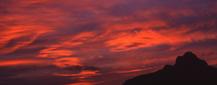
On the other hand, Benicadell is a classic of mountaineering and environmental education, being the referent of many climbers who find in it the fascination of the great mountains, with its long, rocky facade and crenellated by a sharp, slender crest, and enriched for places of deep social and cultural significance.
In short, the Solana del Benicadell is a landscape in whose shape has much to do with human action throughout history, which has created new and diverse environments.
Based on considerations in all aspects to the previous ones, the northern slope of this mountain range, located in the province of Valencia, was declared a Landscape Protected by the Consell de la Generalitat, under the name “Ombria del Benicadell”. The Protected Landscape of the Solana del Benicadell completes the protection of the mountain massif on the slope included in the province of Alicante, which is why both protection initiatives are complementary and mutually reinforcing.
“The majestic Sierra de Benicadell rises strongly in the landscape, crowned by its elegant rocky ridge recognizable at great distances: its profiles, according to the different sides, are facets of the same mountain, which is always the same and different. The sharp wall morphology of the long dorsal facing the still distant sea, separates with two limestone valleys two natural regions, two broad valleys deeply marked by the thousand years of intervention of man, Vall d’Albaida and Foia del Comtat, as well as serves a conventional provincial border between Valencia and Alicante “
Rafael Cebrián. “By the summits of the Valencian Community: 50 selected mountains”
Micro-preserve of Flora del Alt de Senabre
Micro-preserve of Flora del Alt de Senabre
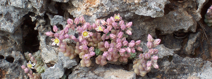
Since 16 January 2007, Beniarrés has its first protected space. It is the Micro flora reserve of l’Alt de Senabre, which includes the public lands of Fantaquí, cova dels nou forats and corralets de l’Encantà. In only 5,61 hectares have been registered more than 250 species, which can give an idea of the biodiversity that treasures the place. Among the protected flora are endemic species, exclusive, rare and / or threatened, which is why the Regional Ministry, based on the botanical report drafted for this purpose, has accepted the request of the Medi Ambient of our city council as to the convenience of protecting this natural space.
This recognition involves the implementation of a management plan for the micro-reserve, which includes signaling its limits, the establishment of information posters, the adaptation of a path, the reintroduction and / or reinforcement of certain tree species, among others , the holm oak, the arbutus or the ash tree, as well as the creation of a seed bank.
| Endemismos ibero-levantinos | Riesgo menor de extinción | Especies vulnerables |
|---|---|---|
| Arenaria levantina | Arenaria levantina | Biscutella montana |
| Arenaria montana | Centaurea spachii | Biscutella stenophylla |
| Biscutella montana | Centaurium quadrifolium | Sarcocapnos saetabensis |
| Biscutella stenophylla | Helianthemum origanifolium | Especies protegidas |
| Centaurea spachii | Hypericum ericoides | Chamaerops humilis |
| Chaenorrhinum origanifolium | Phlomis crinita | Hypericum ericoides |
| Galium lucidum | Rhamnus lycioides | Pholomis crinita |
| Helianthemumÿoriganifolium | Saxifraga corsica | Teucrium buxifolium |
| Rhamnus lycioides | Teucrium buxifolium | Teucrium homotrichum |
| Sarcocapnos saetabensis | Teucrium capitatum | |
| Saxifraga corsica | Teucrium homotrichum | |
| Sideritis tragoriganum | ||
| Teucrium buxifolium |
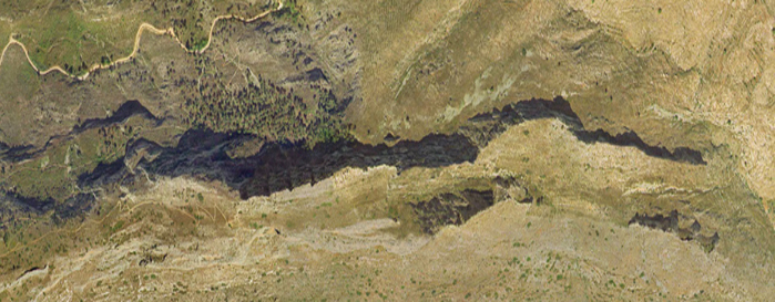
Swamp of Beniarrés
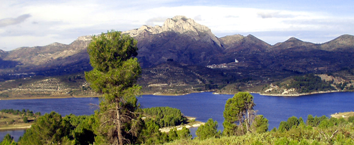
Swamp of Beniarrés
The state-owned Beniarrés reservoir began its construction in the 40’s with the aim of watering the orchards and, fundamentally, the existing orange groves in the Safor region. It has a dam of gravity of 53 meters of height and a sheet of water of 260 hectares, that allows him to embalm until 31 Hm3. The spillway, with flood gates, allows to drain up to 1000 m3 per second.
Upstream of the reservoir, the strong population and industrial settlement (textile and paper mills) causes high levels of pollution in its waters and sediments, so the reservoir has very high levels of eutrophication, anoxia (absence of oxygen) and even acid fumes in the summer. It is estimated that 80% of the flow that reaches the reservoir comes from upstream wastewater treatment plants, and although there is a water purification plan, it seems that this does not show how effective it would be expected. For this reason, the Hydrographic Confederation of the Júcar (CHJ) has repeatedly requested an Environmental Audit of its waters and sediments, as well as to prepare a Program of actions with the aim of achieving, within the term, the objectives that Directive 2000/60 / EC on the quality of water resources.
The natural environment, however, is very pleasing to the eye, a reason that reinforces the conviction that the area of influence of the reservoir has an enormous potential tourism and sports. We are confident that CHJ will become aware of the risks to public and environmental health of the contamination levels achieved and assume its responsibilities with the speed and diligence that would be desirable from an environment ministry. From the Tourist and Medi Ambient Council of Beniarrés City Council there is a firm commitment to demand that it be so.